Neighborhood & Area Maps
Neighborhood Councils
Established to provide advisory input on all areas of government that affect their neighborhood. These could include areas such as finance, parking, planning, zoning, police, and parks, but they are not limited to these topics.
The Councils are advisory to the City Commission, City staff, City Boards and Commissions, and other government entities as well.
For More Information Visit Here.

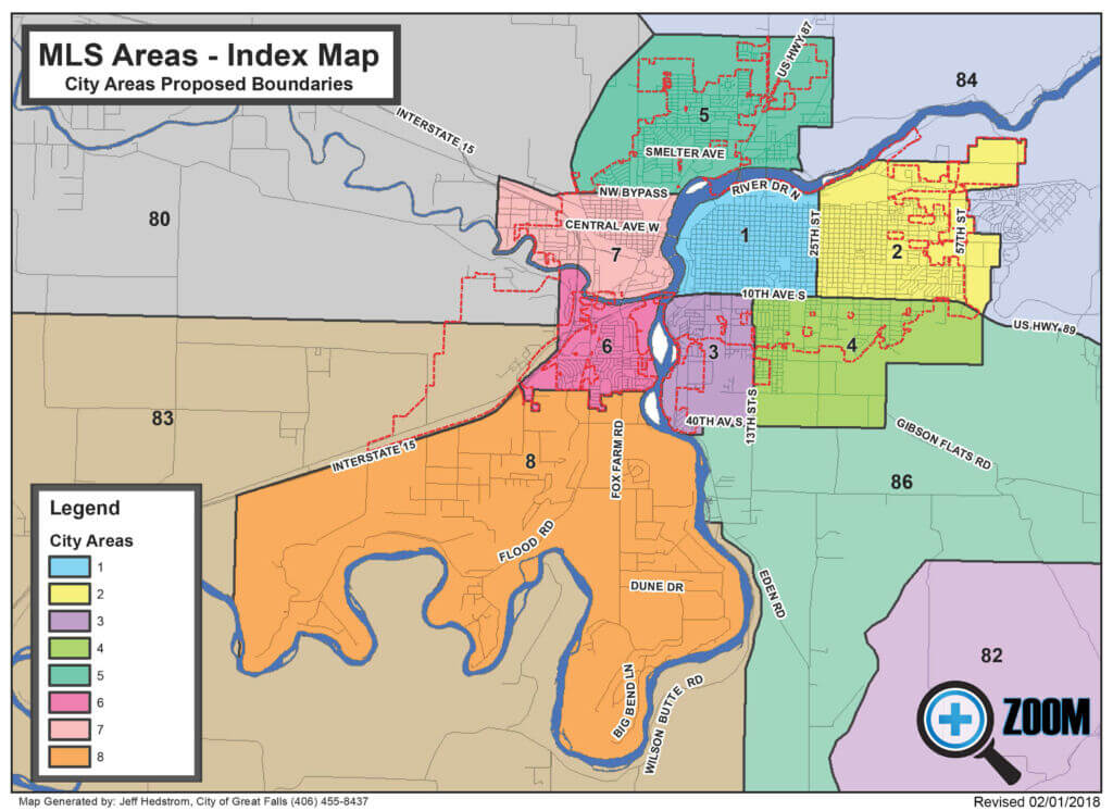
City of Great Falls Area Map
Area 1, Central Great Falls / Downtown - West of 25th St to Missouri River, north of 10th Ave S
Area 2, East Great Falls - East of 25th St to the boundary of MAFB to 10th Ave S
Area 3, South Great Falls - West of 13th St S to the Missouri River, south of 10th Ave S to 40th Ave S
Area 4, Southeast Great Falls - East of 13th St S, south of 10th Ave S to 40th Ave S
Area 5, North Great Falls - North of the Missouri River, north of NW Bypass to north edge of Great Falls-extended line, includes town of Black Eagle
Area 6, Southwest Great Falls - West of the Missouri River, south of the Sun River to the airport boundary, south to the city limits
Area 7, West Great Falls - West of the Missouri River, north of the Sun River, south of NW Bypass
Area 8, Gore Hill / Big Bend / Woodland Estates / Spring Tree Areas - South of the city limits, south of Interstate 15, west and north of the Missouri River to an extended line just outside of Ulm
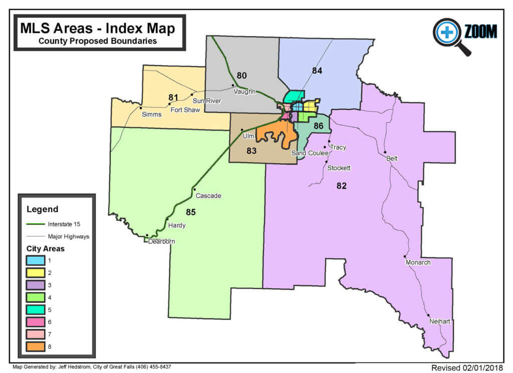
Cascade County Area Map
Area 80 - Northwest of Great Falls City Areas, includes towns/places of Vaughn, Sun Prairie and Manchester
Area 81 - West of Area 80, includes towns of Sun River, Fort Shaw and Simms
Area 82 - Southeast of Great Falls City Areas, includes towns of Tracy, Belt, Stockett, Monarch and Neihart.
Area 83 - Southwest of Great Falls City Areas, south of the Missouri River, includes town of Ulm
Area 84 - Northeast of Great Falls City Areas, includes Bootlegger Road region
Area 85 - Southwest of Area 83, south of Area 81, southwest portion of the county, includes the towns/places of Cascade, Hardy and Dearborn
Area 86 - Southeast of Great Falls City Areas, east of Missouri River, east of Wilson Butte Rd properties, includes Gibson Flats and Eden regions